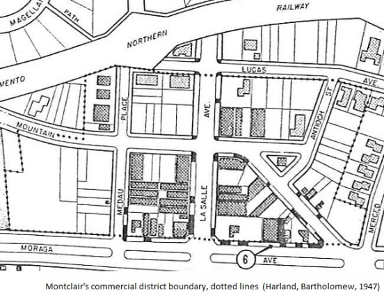
Back in 1947, Montclair Village’s commercial district already existed and was fully platted. As portrayed by this official map, our village should look familiar to modern-day Montclarions.
In the map, it’s easy to locate Mountain, LaSalle and Antioch — including the Coffee Central triangle. You’ll also find some parking, with six (see the encircled “6”) spots designated on Moraga Avenue.
Sure, there are a few changes. All those empty lots have been built out and transformed many times. Now the Sacramento Northern is kaput, while Highway 13 rumbles alongside the Village.
Yet we still find comfort in what hasn’t changed in nearly 65 years.

And fortunately, as we learned on today’s Oakland Heritage Alliance tour (or you may seen on one of the signs on the railroad trail), CalTrans didn’t build the planned highway 77 in Shepherd Canyon. Our lovely little village would be quite different with another freeway running up Shepherd Canyon and ramps to and from highway 13.
I’ll be posting about the OHA tour later.
As promised, here is Gene’s link about the Shepherd Canyon tour – click here.