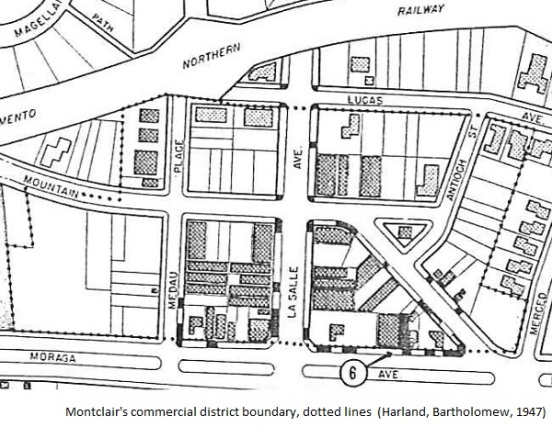
No true shock: Montclair really isn’t an Oakland neighborhood. The latest maps reveal our ragged geographic demarcations, in what’s collectively called the Montclair District by its denizens.
Despite the ambiguity, we still share a sense of place as defined by hills and canyons, catastrophic events, historical real estate developments and whomever lives next door.

Recently Our Oakland took a stab at mapping every single extant neighborhood throughout the City of Oakland. We relish this effort, which combines many different sources. What’s more, because it’s on Google, you can play around with different overlays and views.
So where are we?
Let’s start with the largest definition of the Oakland Hills, which represent “our claim” on the Berkeley Hills. Some of the Oakland Hills are called the North Hills, which tries to smooth over the Berkeley divide as well. These northern reaches include Panoramic Hill, Claremont Hills and Hiller Highlands.
Moving south of the Caldecott Tunnel, the labeled neighborhoods include Merriewood, Glen Highlands and even portions of Upper Rockridge. We’re not sure anyone says they live in “Glen Highlands” these days. And while Rockridge isn’t considered Montclair, it shares a tight bond from the devastating Oakland Firestorm of 1991.
Traveling down to the southern reaches, the large Piedmont Pines development is nestled between Shepherd Canyon and Skyline. And much like Michigan, this neighborhood’s bifurcated: a small section exists on the far side of Joaquin Miller Park.
Parts of the Hayward Fault, running along Highway 13, also mark our borders successfully. However the “Montclair core” jumps the line here, with many homes sited between Moraga Avenue and Park Boulevard. We weren’t around before the highway was built, and it probably felt like a unified area back then.
How else are we defined?
The City of Oakland likes to call us Beats 13Y and 13Z, essentially north and south of Thornhill. It’s a neat definition based on the original canyon road used by Hiram Thorn for logging operations, and likely divides up the patrolling duties. But there are no real differences among Montclarions on either side.
We are clearly unified by the 1991 firestorm. When asked where you live, neighbors residing in the rebuilt zone will often mention that fact in casual conversation. If your home was destroyed, then you let other people know about it. Even if you lived in untouched areas back then, you were touched by an experience that brought everyone together.
In the end, the people probably define Montclair District best. A few of the earliest homeowners or their descendants are still living here, who pass on their stories. It’s not only about the fire, either. If you remember the one snowfall in the early 1970s, then you are a true-blue Montclarion too. On my block, there are some old-timers and their memories help us live here – maps or not.


